


Explore the breathtaking beauty of the Gifford Pinchot National Forest on this thrilling mountain biking adventure. Traverse from Elk Pass, off the 25 road, all the way down to the Lewis River, experiencing the rugged terrain and stunning landscapes along the way.
Starting Point: Begin your journey at Elk Pass, venturing eastward on the Boundary Trail towards Badger Peak and Badger Lake.
Scenic Stops: Pause at Badger Peak for a panoramic view of the surroundings and a glimpse of the terrain ahead. Badger Lake offers a serene spot for relaxation and rejuvenation.
Landmark Highlights: Continue towards Shark Rock, a striking fin-shaped outcropping offering captivating vistas of the Gifford Pinchot National Forest.
Thrilling Descents: Descend from Craggy Peak, enjoying exhilarating trails as you make your way down to the valley floor.
Trail Finale: Conclude your ride on the Wright Meadow Trail, a picturesque PNW loamer trail adorned with towering trees, intricate roots, and playful twists and turns.
Van Pickup: The van awaits at the trailhead to whisk you away after a memorable day on the bike.
Trip Details:
- Duration: 10 hours car door to car door
- Trail Difficulty: Intermediate to advanced.
- Recommended for: Experienced riders seeking scenic trails and challenging descents.
Experience the Unforgettable Elk Pass to Lewis River Trail. Book Now!
2024 TRIP DATES:
9/8
1 Day Guided Trip
$149
Per Person / Per Day
BOOK NOW
E-BIKE FRIENDLY
Distance
(per day)
Ascent: 3,500’
Decent: 6,000’
Estimated Mileage: 21 Miles
Day Trip Includes:
- Professionally guided tour of remote single track
- Shuttles
MAKE IT A WEEKEND
Pair this with Strawberry Mountain the Day Before
Meeting Spot
Elk Pass Trailhead
Shuttle Departure : 9:00 AM
Please arrive 15 minutes early.
CELL PHONES: DO NOT WORK HERE, Have an offline MAP available for reference.
MAP: 822 :: Mount St. Helens, Mount Adams [Gifford Pinchot National Forest]
PURCHASE MAP – CLICK HERE
Ride Description
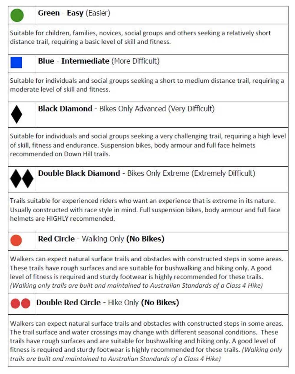
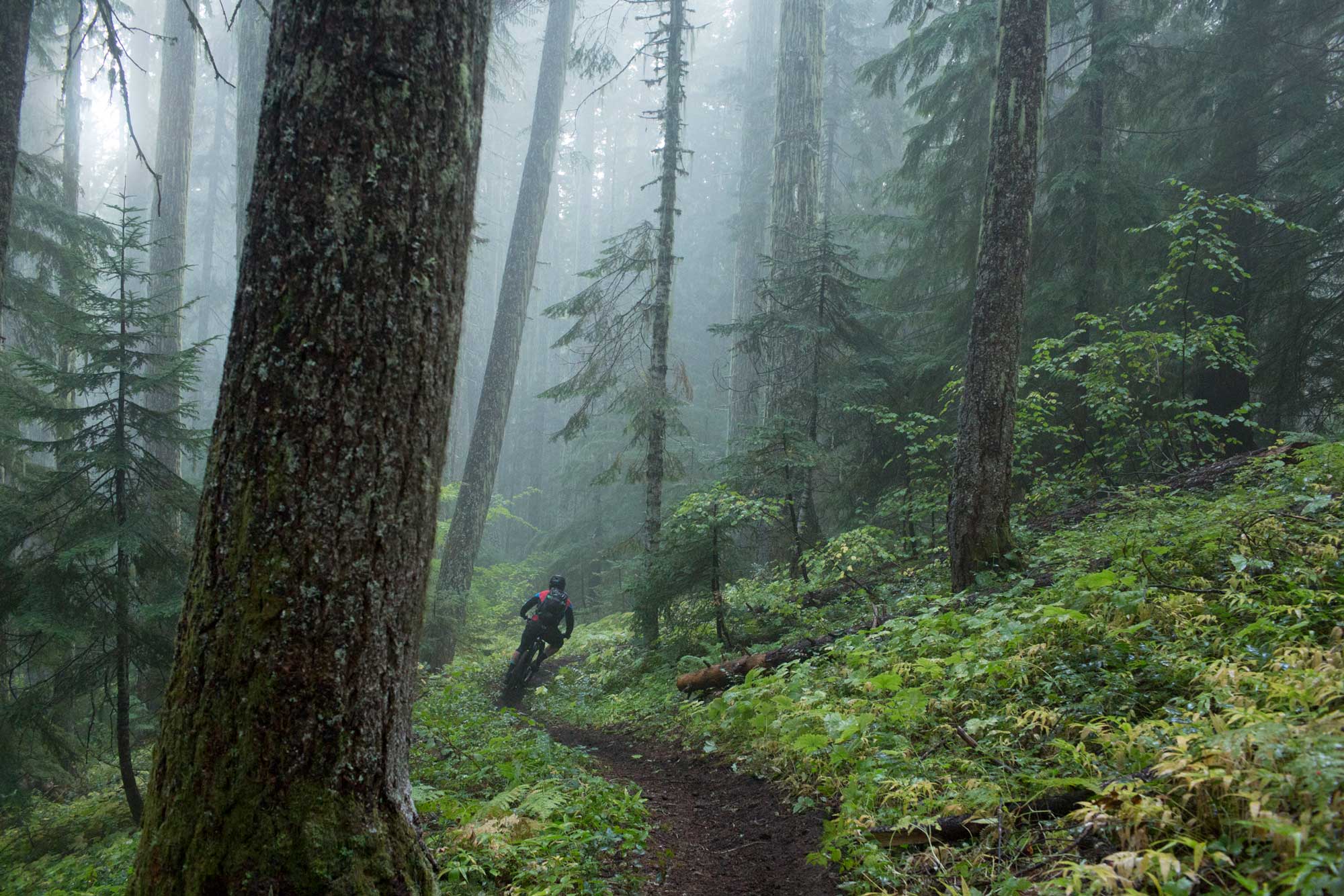
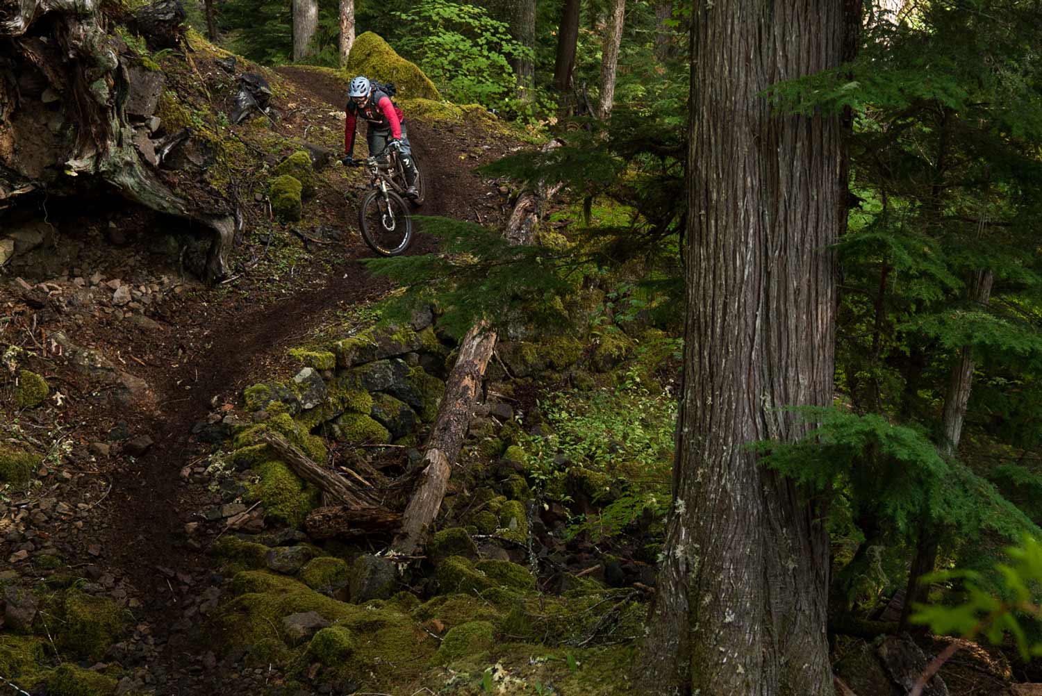
This is one of our favorite rides in the Gifford Pinchot National Forest and what we consider part of the Mt. St. Helens backcountry riding area. This ride begins at Elk Pass, off the 25 road and traverses the National Forest all the way down to the Lewis River. We begin by heading east on the Boundary Trail, heading towards Badger Peak and Badger Lake. Badger Peak is a great out and back we like to include on this ride. This peak offers a great POV and a chance to observe your surroundings and a glimpse of the terrain you will be traveling on throughout your ride. For those interested in a more relaxed kind of day, kick back and relax at Badger Lake, a crystal clear private lake worth a dip and a nap.
We’ll collect ourselves back at Badger lake and continue our journey on the boundary trail heading East towards our second landmark, the fin shaped Shark Rock. Another incredibly beautiful Rock Outcropping with a great view point and a look into the expansiveness of the Gifford. We’ll continue to head east until we hit Craggy Peak, the first large chunk of descending we’ll do as we make our way off of the ridge and down to the valley floor. Craggy eventually runs into the Wright Meadow Trail where we will finish our ride. Wright Meadow is your quintessential PNW Loamer and photogenic trail. Huge trees and roots, amazing soil type, and a trail design that is super playful and a great way to end your day. The van will meet us at the Trailhead, we’ll hop back in after we’ve had the chance to clang some cans and cheers to a great day on the bike!
Mt St Helens Backcountry
70° Humidity:47% Clouds:10% Wind (SSW):15mph clear sky
Monday, 07/01 78°FTuesday, 07/02 83°FWednesday, 07/03 75°FThursday, 07/04 73°FFriday, 07/05 87°F


